pash wrote:From last year:
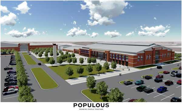
I didn't notice this previously, but that rendering seems to place the buildings on a landscape near Junction City....(which is a fine idea.)
pash wrote:From last year:
40,000 car parking lot for the BBQ.kcjak wrote:And doesn't this proposal include additional surface parking to accommodate Royal events?


all of them. new ordinance supporting demolition on the floor this afternoon.beautyfromashes wrote:Hate this! Who on the council deserves my wrath?
actually, that's not too far off reality. there's no tall buildings that direction. the only things missing are bridges. there are no tall buildings along the river at that view. the river is the brown blob above one of the buildings for perspectiveloftguy wrote:
I didn't notice this previously, but that rendering seems to place the buildings on a landscape near Junction City....(which is a fine idea.)

They need something to represent their occasional occupant.taxi wrote:I'd bet that cow is getting tired of mooving.


Not quite sure that 1951 scenario would happen again, that flooding was not due to levee failure. One, there was an extended period (weeks) of rains in the Kaw River basin. Two, when that flood happened there were no upstream dams holding back water. Three, since then the levees have been built up.And when the levee along the Kansas River fails, this is what it looks like
True, but in 1993 the levees held but were almost topped. Think most of the local levees are concrete with an earth cover.It doesn't matter how tall you make a levee. Failure often comes from the levee collapsing from saturation, and flooding also comes from sand boils on other side.